The center of the European part of the country is usually called the central strip of Russia or in another way the central Russian region. It must be understood that this term is rather arbitrary. There are several areas whose belonging to the middle lane is indisputable. These are Moscow and the regions adjacent to it: Tver, Kaluga, Tula, Ryazan, Yaroslavl, Vladimir, Smolensk. In addition, the Oryol, Bryansk, Lipetsk, Kostroma, Ivanovo regions are usually included here.
The territory of central Russia is characterized by a temperate continental climate and the landscape of the East European Plain. Most regions of the region do not have minerals in their bowels. Their main natural wealth is an extensive network of lakes and rivers, as well as mixed and broad-leaved forests.
The Central Russian region is the most densely populated part of Russia. Here, cities are located at a small distance from each other, and people live in a rather dynamic rhythm, especially in Moscow. Naturally, from time to time there is a need to relieve the accumulated stress and devote at least a few days to the improvement of the body. In order not to waste time, effort and money on the road, you should pay attention to the health resorts of central Russia. They offer not only to relax in peace and quiet, but also to undergo a course of treatment using such natural factors as mineral waters and healing mud of peat bogs and lakes.
In the center of the East European Plain, a huge reservoir is hidden under the ground, called the Moscow artesian basin. With the help of deep wells, its mineral waters are brought to the surface at different points in the Central Russian region. Balneological resorts are equipped near such wells. If there are deposits of mud nearby, then they are also used for healing. Many resorts are located in forest park areas with a special microclimate. The positive aspects of rest in the "home" resorts include the lack of acclimatization. In familiar weather conditions, the positive effect of wellness procedures is felt from the first days.
The first resort in the region was founded in a forest area near Lipetsk. The construction of the Badera Baths on the salty Lipetsk waters began in 1719 on the personal instructions of Peter I. The main healing resource of the resort - chloride-sulfate-sodium water, was eventually supplemented with healing mud from a peat deposit near the village of Dvurechka.
Now the resort operates a sanatorium "Lipetsk". It is focused on helping people suffering from diseases of the skin, digestive, musculoskeletal, nervous, endocrine and reproductive systems. The multidisciplinary sanatorium "Voskhod" specializes in the treatment of children. Guests of the resort can diversify their leisure time with walks around Lipetsk and a trip to Yelets.
In the Moscow region, sanatoriums were built mainly in forest park areas. In places where it was possible to bring the mineral waters of the underground Moscow basin to the surface. Many of these sanatoriums use local (sapropel and peat) or imported mud for wellness procedures. The medical base of numerous sanatoriums of the Moscow region is considered one of the best in the country. Top notch and comfort level. True, the prices for accommodation and treatment in them are somewhat higher than in neighboring regions.
The former estate of Yakov Bruce in the Shchelkovsky district, located at the confluence of the Vorya and Klyazma rivers, was assigned to the Monino balneological sanatorium. His main profile is the treatment of gastroenterological diseases.
 Sergiev Posad sanatorium "Zagorskie Dali" is quite popular among residents of the Moscow region. It has two sources of mineral water suitable for baths and internal use. The medical base of "Zagorskie Dali" is suitable for the treatment of nervous, respiratory, musculoskeletal diseases. Not far from the sanatorium is Sergeev Posad and a favorite place of rest for Russian artists of the 19th century - the Abramtsevo estate.
Since 1965, the multidisciplinary sanatorium "Valuevo" has been operating. It was equipped in the Leninsky district in the estate of Count A.I. Musin-Pushkin. In "Valuevo" they use mud therapy, balneotherapy. The sanatorium has a bath complex, halo and speleological chambers, health paths for recreational walks.
At 204 km. from Moscow in the provincial town of Kashin is the most famous balneo-mud resort in the Tver region. It stands out among others with a variety of mineral waters with different chemical composition. From a number of diseases of the digestive system relieves the use of sulfate calcium-sodium-magnesium water. The rest of the water is suitable for showers and baths. In local sanatoriums, applications are made with freshwater non-sulfide and peat mud. They are effective in violations of the musculoskeletal system and gynecological diseases.
 In the former estate of the princes Gagarins in the Konakovo district on the banks of the Volga, there is another balneological resort in the region - Karacharovo. It relieves a number of diseases. Only 120 km separates Karacharovo from the capital. way.
Tourist cities of the region are: Tver, Staritsa, Torzhok and Kimry. In Kalyazin, you can see the bell tower of St. Nicholas Cathedral, which rises from the waters of the Uglichevsky reservoir.
The Tula resort of Krainka has gained the reputation of the best “kidney” health resort. The sanatorium of the same name is located on the banks of the Cherepet River, from the floodplain of which sulfide peat is mined for mud procedures. It was decided to establish the resort because of the Krajinsky mineral water deposit, which was already known in 1844. Now the sanatorium uses water from four of its sources. They have a different composition and degree of mineralization. These waters are extremely useful in diseases of the digestive and urinary systems.
 Krainka is not the only balneological resort in the Tula region. 25 km. from Tula there is a military sanatorium "Slobodka", and in the Zaoksky district - "Velegozh".
The Tula region is not deprived of sights. What is the museum-estate "Yasnaya Polyana" worth, where L.N. Tolstoy. Of interest from a historical point of view are Kulikovo field and Bogoroditsk.
Ancient Kostroma, which is part of the Golden Ring of Russia route, turned out to be rich not only in ancient architectural monuments, but also in sources of healing mineral waters and mud. Several sanatoriums successfully operate on their basis. People with gynecological and nervous diseases, as well as problems with the musculoskeletal system, should pay attention to the sanatorium of the city of Soligalich, 230 km away. from Kostroma. It uses local salt water and peat mud for balneo-mud treatment. In the small village of Susanino in the suburbs of Kostroma, there is a boarding house named after. Ivan Susanin. On its territory there is a well with mineral water and a unique elk farm. Moose milk is used for medicinal purposes. It is prescribed to patients with diseases of the digestive system. Also, the doctors of the sanatorium practice acupuncture, homeopathy and more traditional methods of treatment. Not far from Susanino are the ancient cities of Nerekhta and Tutaev.
Each of the regions of central Russia has its own unique cultural monuments and natural objects. The route of the Golden Ring of Russia, beloved by Russian and foreign tourists, passes here. Such a concentration of ancient churches, monasteries, luxurious noble estates, estates and museums is no longer in any region of the country. Fascinating excursions and effective treatment are the main advantages of a holiday in the central regions of Russia.
0The territory of the Russian Federation is very vast and occupies a vast expanse of land on the earth's surface. It stretches for thousands of kilometers across Eurasia, washed by the seas of three oceans, contains a colossal number of rivers and lakes. The relief of the surface varies from steep mountains to lowlands lying under sea level.
Russia includes almost all climatic zones that are on Earth - from hot subtropical to icy Arctic.
In the north-west of Russia, a maritime climate reigns. When moving to the center of the Russian Federation, it changes to a continental climate and further - to a subtropical one in the city of Sochi, near the Black Sea. In Siberia, the climate is sharply continental, while monsoons reign in the Far East. All this is the result of a significant length of the territory of the Russian Federation from east to west and from north to south.
Climate zone- this is a wide area of the earth's surface, within which an approximately uniform climate is created throughout the entire length of such an area. The earth is divided into 4 conditional main zones: polar, temperate, subtropical and tropical. Basically, natural-climatic zoning occurs due to different heating of the Earth's surface by its luminary - the Sun. The main division occurs along the meridians. Inside Russia, the division into climatic zones basically coincides with the twentieth, fortieth, sixtieth and eightieth meridians - that is, multiples of 20.
To determine the temperature of the comfortable mode of operation of suits and jackets, tests were carried out in a specialized climatic chamber of the Research Institute of MT RAMS
| 1 ZONE | Astrakhan Region Belgorod Region Volgograd Region Kaliningrad Region Republic of Kalmykia Rostov Region Stavropol Territory Republic of Adygea Republic of Dagestan Republic of Ingushetia Kabardino-Balkar Republic Karachay-Cherkess Republic Republic of North Ossetia-Alania Chechen Republic Krasnodar Territory |
| 2 ZONE | Bryansk Region Vladimir Region Voronezh Region Ivanovo Region Kaluga Region Kursk Region Leningrad Region Lipetsk Region Republic of Mari El Republic of Mordovia Moscow Region Nizhny Novgorod Region Novgorod Region Orel Region Penza Region Primorsky Territory Pskov Region Ryazan Region Samara Region Saratov Region Smolensk Region Tambov Region Tver Region Tula Region Ulyanovsk Region region Chuvash Republic Yaroslavl region |
| 3 ZONE | Republic of Altai Amur Region Republic of Bashkortostan Republic of Buryatia Vologda Region Irkutsk Region (except for the areas listed below) Republic of Karelia Kemerovo Region Kirov Region Kostroma Region Krasnoyarsk Territory (except for the areas listed below) Kurgan Region Novosibirsk Region Omsk Region Orenburg Region Perm Region Sakhalin Region (except regions listed below) Sverdlovsk Region Republic of Tatarstan Tomsk Region (except for the regions listed below) Republic of Tyva Tyumen Region (except for the regions listed below) Udmurt Republic Khabarovsk Territory (except for the regions listed below) Chelyabinsk Region Chita Region Republic of Khakassia Trans-Baikal Territory |
| 4 ZONE | Arkhangelsk region (except for areas located beyond the Arctic Circle) Irkutsk Region (districts: Bodaibinsky, Katangsky, Kirensky, Mamsko-Chuysky) Kamchatka Region Republic of Karelia (to the north of 63° north latitude) Komi Republic (areas located south of the Arctic Circle) Krasnoyarsk Territory (territories of Even Autonomous Okrug and Turukhansky District located south of the Arctic Circle) Kuril Islands Magadan Region (except for the Chukotka Autonomous Okrug and the areas listed below) Murmansk Region The Republic of Sakha (Yakutia) (except for the Oymyakonsky District and areas located north of the Arctic Circle) Sakhalin Region (regions: Nogliksky, Okhinsky) Tomsk region (districts: Bakcharsky, Verkhneketsky, Krivosheinsky, Molchanovsky, Parabelsky, Chainsky and the territories of Aleksandrovsky and Kargasoksky districts located south of 60 ° north latitude) Tyumen region (areas of the Khanty-Mansiysk and Yamalo-Nenets autonomous circles, except for areas located north of 60 ° northern latitude) Khabarovsk Territory (districts: Ayano-M Ai, Nikolaev, Okhotsk, named after Polina Osipenko, Tuguro-Chumikansky, Ulchsky) |
| SPECIAL ZONE | Magadan region (districts: Omsukchansky, Olsky, Severo-Evensky, Srednekansky, Susumansky, Tenkinsky, Khasynsky, Yagodninsky) Republic of Sakha (Yakutia) (Oymyakonsky district) Territory located north of the Arctic Circle (except Murmansk region) Tomsk region (territories of Aleksandrovsky and Kargasoksky regions located north of 60°N) Tyumen Region (areas of the Khanty-Mansiysk and Yamalo-Nenets Autonomous Okrugs located north of 60°N) Chukotka Autonomous Okrug Nenets Autonomous Okrug |
The entire north of Russia and the islands of the Arctic Ocean are located in the arctic and subarctic zones; the middle zone of the Russian Federation has a temperate climate zone. The south is located in the subtropics, but it is very insignificant - even 5% of the territory of the Russian Federation is not included in this zone.
 The coldest point on the territory of the Russian Federation is the "pole of cold", located near the city of Verkhoyansk (pictured). The thermometer can drop to -62 degrees Celsius. Whereas Sochi, being in the subtropical zone, boasts temperatures up to +38 Celsius in July. But this is not a record - the absolute maximum in Russia was recorded at +45.4 ° C, at the Utta weather station, Kalmykia.
In the European part of the Russian Federation, the climate is more moderate. In Moscow in January, the average temperature is between -9 °С and -16 °С, and in July from +13 °С to +23 °С.
Arctic climate of Russia
 Tundra and arctic deserts are located here. The conditions are so harsh because the soil hardly warms up - the rays of the Sun only glide over the surface of the planet here, not transferring enough heat. The animal and plant worlds in the Arctic climate are scarce due to lack of food. Polar nights increase the negative effects of the harsh climate, and the temperature can drop to minus 60 degrees Celsius in winter. The duration of winter is approximately 10 months, and in summer the earth does not have time to get enough heat, because. summer in such a climate lasts no more than 2 weeks, with temperatures up to +5.
In the Arctic Ocean, the temperature is slightly higher in winter, which is explained by heat transfer from water masses to air.
You may also be interested to know about the choice of heaters for work in ultra-cold weather conditions. You can read more about this in our material about.
What is holofiber and why is it better than traditional heaters, like synthetic winterizer -.
subarctic belt
Winter in the subarctic climate is cold and long, but less severe than in the Arctic zone. Summer is warmest by 5-7 degrees, but also short. Precipitation is more frequent, but less abundant than in arctic climates. Arctic cyclones often pass here.
Climate of the temperate zone of Russia
 Temperate zone the largest in terms of area, length and population in the Russian Federation. The seasons are clearly defined: autumn, winter, spring and summer.
The temperate zone is subdivided into 5 regions due to the tangible differences in climate between them:
- The Sea of Okhotsk with Magadan are located in the area of maritime climate;
- Half of the Amur River, which flows into the Sea of Okhotsk and the city of Vladivostok, are in the monsoon climate;
- Yakutsk, Chita and Lake Baikal are included in the area of sharply continental climate;
- Krasnoyarsk and Tobolsk are located in the area of continental climate;
- St. Petersburg, Moscow and Astrakhan are located in the temperate continental climate.
Moderate continental climate zone of the Russian Federation
It has hot summers (up to +30°С) and frosty winters (up to –30°С). The temperature fluctuation for the year is up to 60 degrees. The climate is formed under the influence of Atlantic air masses. Due to the different moisture content of the soil and air, natural zones change from taiga to steppe.
Continental climate zone of Russia
 It is formed under the influence of air masses coming from the west. At the same time, air masses moving in the opposite direction from the north and south meet and this results in three times more precipitation than in the south. The average temperature in July reaches +26°С, in January – up to –25°С. The natural zones of this climate have a wide diversification along the way of their entire length, from the frozen taiga to the steppes with emerald grass.
Sharply continental climate
The air of temperate latitudes dominates here. Characteristic features of this climate are low cloudiness and a small amount of precipitation. The earth's surface quickly heats up in summer and cools down in winter, which gives hot summers and frosty winters. In winter, the soil freezes heavily.
Monsoonal and maritime climates
 In winter, atmospheric pressure increases, so cold and dry air masses rush to the ocean, where the air is warmer (water cools more slowly). At the arrival of summer, the mainland warms up better than water masses (they need more time for this), and cold air rises to the continent. Therefore, strong winds arise, which are called monsoons, which gave the name to the climate.
Sometimes there are typhoons. Precipitation in summer is frequent and plentiful. Frequent floods. Summers are cool here (15-20°С in July), and winters are cold, down to –40°С (average 25°С). Near the sea itself, the climate is smoother, both in summer and in winter.
Subtropical climatic zone of the Russian Federation
There are almost no subtropics in Russia - just a couple of notable cities huddled on a narrow strip of the Black Sea coast from the Caucasus Mountains. It is they who close the coast of the warm sea from the masses of cold air that move from the East European Plain. In the coldest month, the temperature does not fall below zero degrees. Summer is not hot, as for a subtropical climate, but long. There is a lot of precipitation due to the proximity of the mountains, but with an even distribution throughout the year.
There are no other climatic zones (equatorial, tropical) in Russia.
Road-climatic zoning of Russia

The road-climatic zone is a part of the country's territory, which is characterized by homogeneous features of the construction of roads, approximately the same climatic conditions, average uniformity of the water surface and approximately similar indicators of soil freezing and groundwater depth.
Brief description of road-climatic zones
| Road-climatic zones | Approximate boundaries and a brief description of each of the road-climatic zones |
| 1 | Cold tundra covered with forests and permafrost are located north of the line of designated cities: De-Kastri - Birobidzhan - state border - Kansk - Tunguska - Dry - Oshkurya - Nes - Ponoy - Monchegorsk. |
| 2 | Forests with constantly abundantly moist soils are located from line 1 to the border of line 2: the state border - Kansk - Tomsk - Kyshtym - Ustinov - Gorky - Tula. |
| 3 | Further, the forest-steppe with periodically abundantly moistened soils spread: Turan - Biysk - Omsk - Magnitogorsk - Kuibyshev - Belgorod - Kirovograd - Chisinau. |
| 4 | In zone 4, you will no longer find abundantly moistened soils. Line Volgograd - Kizlyar - Buynaksk - Stepanakert - Julfa. |
| 5 | The last, fifth zone is located southwest of zone 4. It includes desert places with an arid climate and very salty soils. |
Why do we need climate zones?
Climate zones- this is a conditional division of the space of a country or planet into regions with different climates, which affects the diversity of living conditions. Climatic zones are studied by mankind in order to understand the optimal conditions for the development of a particular territory. As a rule, living in cold zones has more costs, but they contain more of the wealth of nature - minerals and fossil fuels. The hot zones are good for farming, farming and recreation. The temperate zones are suitable for the life of the majority of the population.
Where knowledge about climate zones finds its application
Knowledge about climatic zones is used for a wide range of needs:
- When constructing buildings, structures. Each construction project must take into account the characteristics of the area. For buildings, this is the thickness and material of the walls, the presence or absence of waterproofing of the foundation, the density and type of roof material, the need for deep communications, etc.
- When designing engineering communications- the use of material, the need for additional protection from cold or heat, the need to use special construction materials.
- When building roads- the thickness of the coating, the need for additional strengthening or elevation of the soil, the possibility of laying above-ground or only underground utilities and their protection.
- When planning the extraction of natural resources– what design of wells, plants and communications should be used.
- When assessing the possibility of human habitation- it is recommended or not for people to live in specific conditions, an assessment of their living and working conditions, which determines the complexity of building cities and the amount of payment to workers for the presence or absence of extreme conditions.
- When laying railroads- frequency of piles, number of fasteners, construction budget.
- In agriculture, fish farming and plant growing– which species can live in such a climate and which cannot; the profitability of such an enterprise as a whole.
- When planning resorts, being tied not only to the climate, but also to the features of a particular place. This is how skiing and balneological resorts, popular beaches and salt healing caves may appear.
Central Russia is a vast region located on the East European Plain. It is customary to divide the entire territory of Central Russia into two large regions - the Non-Chernozem and the Chernozem. Due to its significant size, there is a wide variety of geographical and climatic features inherent in different areas.
Weather in Russia (Moscow) now:
The climate of Central Russia is temperate continental. Remoteness from the seas leads to significant differences in annual temperatures. The central regions of Russia are characterized by long frosty winters, rather short and warm, even hot summers, long springs with recurrent cold weather, and long, rainy autumns.
The average monthly temperature in January, depending on the region, is minus 7-14 degrees, in July - plus 16-22 degrees.
Climate of Central Russia (Moscow) by months:
Spring

Spring in central Russia is the time when long-awaited warmth replaces the harsh winter frosts and nature comes to life. But this process never occurs evenly: there are sharp warmings, then prolonged cold snaps with frosts and snowfalls.
The beginning of spring is considered mid-March, when the snow begins to melt actively. Only by the end of March are positive daytime temperatures established, although until mid-April there are many frosty days and nights.
In early April, the snow cover melts everywhere, it becomes much warmer, and by mid-late May the weather, as a rule, becomes truly summer. However, return colds and even frosts occur at this time, and in some years they continue into early June.
Summer

Summer in Central Russia is rather short, but warm, with moderate humidity. Sometimes exhausting heat sets in when the air temperature approaches the 30-degree mark, but for a short time. Usually during the day it is 22-25 degrees.
In summer, Atlantic cyclones often come to the center of Russia, bringing with them moist, cool air. There are many cloudy days, rains are often accompanied by thunderstorms, there are showers, hail, storm winds. Fogs are more typical for the end of July and August.
Often the situation is reversed: an anticyclone comes and the weather becomes dry and hot.
In general, summer weather in Central Russia is very comfortable and stable.
Autumn

Despite the cold snap, the weather in early autumn remains summer. There are many warm, clear days in September and even early October. This period is called "Indian summer". Gradually it gets colder, night and morning frosts, heavy fogs begin. There is more and more precipitation, autumn in central Russia is the wettest season.
October (especially its second half) is characterized by a sharp deterioration in the weather. It becomes cold, chilly winds begin, it often rains, wet snow. A temporary snow cover may appear, which quickly melts and turns into slush.
November is pre-winter. Average temperatures gradually overcome the zero barrier. By the end of the month, frosty weather prevails, snow falls almost everywhere.
Winter

Frosty snowy winter is a climatic norm and a kind of “visiting card” of Central Russia. Winter begins in the last decade of November and lasts until mid-March. Average temperatures range from 2 to 12 degrees below zero, but can vary significantly depending on the specific region and month.
The coldest month is January, it is after the New Year that extreme frosts below 30 degrees occur, which sometimes last longer than a week. In February, there are heavy snowfalls, the thickness of the snow reaches its maximum values, but there are also strong thaws, foreshadowing the arrival of a distant spring.
The term had an applied value in the conditions of the agrarian economy, allowing you to quickly group administrative units according to climatic zones. After the revision of the administrative-territorial division of Russia by Paul I, the abolition of governorships and the creation of provinces in 1796, the term continued to be used mainly by agronomists, foresters, meteorologists and botanists. For this reason, this definition is not in the Encyclopedic Dictionary of Brockhaus and Efron (1890-1907). The return takes place in Soviet times. The phrase is present in some popular science publications from at least 1940. For example, plant guides P.F.
Central Russia
Attention
Pisces[edit | edit source] Insects[edit | edit code]
- central Russia
- Central Federal District
- Central economic region
- the East European Plain
- Central Russian Upland
- Non-chernozem zone, non-chernozem zone, non-chernozem zone
- So, there is no definition of this term either in the Geographic Dictionary, or in the Great Soviet Encyclopedia, or in school textbooks on geography.
- ed. A. F. Tereshnikova. Geographic encyclopedic dictionary. Concepts and terms. - Moscow: Soviet Encyclopedia, 1988.
- S. 289. - 431 p.
- 7th edition. - Edition M. and S.
What are the cities of central Russia, a list
Encyclopedic YouTube
- Grapes in Central Russia
- 1 History term
- 2 Geography term
- 3 Spelling term
- 4 Climate middle band
- 5 Relief medium band
- 6 Hydrography
- 7 Plant world
- 8 Animal world
- 8.1 Mammals
- 8.2 Birds
- 8.3 Pisces
- 8.4 Insects
- 9 See also
- 10 Comments
- 11 Notes
- 12 Literature
The history of the term first appears in the Charter on the Forests of 1785 and in the “Review of the Russian Empire in its current newly built state” (1787) by Adjutant Paul I S. I. Pleshcheev, where the entire territory of Russia is divided into the Northern, Middle and Midday strips. The bands were divided into governorships, and those, respectively, into counties.
Where is the central strip of Russia?
- Moscow
- Smolensk
- Tverskaya
- Yaroslavskaya
- Vladimirskaya
- Ryazan
- Tula
- Kaluga
- Orlovskaya
- Bryansk
- Kostroma
- Ivanovskaya
- Nizhny Novgorod
- Leningradskaya
- Pskovskaya
- Novgorod
- Vologda
- Kursk
- Belgorodskaya
- Lipetsk
- Voronezh
- Tambov
- Kirovskaya
- Mari El Republic
- Chuvashia
- Mordovia
- Penza
- Saratov
- Ulyanovsk
- Samara
Tatarstan, Udmurtia, Bashkortostan, Orenburg region, Perm region, Republic of Komi are not included in the middle zone.
Important
Geographic encyclopedic dictionary. Concepts and terms. - Moscow: Soviet Encyclopedia, 1988. - S. 289. - 431 p.
- P.F. Mayevsky. Spring flora of central Russia. - 9th edition. - Edition of M. and S. Sabashnikovs, 1925. - 120 p.
- P.F. Mayevsky.
Autumn flora of Central Russia. Tables for determining plants that bloom in autumn. - 7th edition. - Edition of M. and S. Sabashnikovs, 1926. - 134 p. - 6000 copies.
- 10th edition. -
Info
Edition of M. and S. Sabashnikovs, 1928. - 120 p.
- M.-L.: Selkhozgiz, 1940. - 823 p. - 7000 copies.
In central Russia are the sources and upper reaches of the Volga, Don, Dnieper, Western Dvina and their tributaries. The rivers of central Russia are characterized by small channel slopes - from 0.2 m / km to 1 m / km, rarely up to 1.6 m / km, on average 0.5 m / km. The middle belt is characterized by broad-leaved and mixed forests.
In the north - in the Pskov, Yaroslavl, Kostroma, Kirov regions - the middle strip borders on the taiga strip. In the south - in the Voronezh, Kursk, Oryol, Lipetsk, Tambov, Penza regions and Mordovia - with a forest-steppe zone. Mixed forests of the middle belt are also distinguished as a subtaiga zone.
The main tree representatives of deciduous forests are: oak, linden, birch, maple, ash, elm.
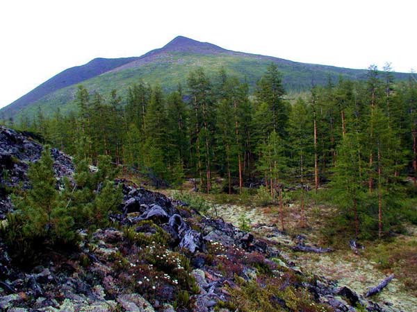
A typical landscape of central Russia. The Sturgeon River near the city of Zaraysk, Moscow region Central Russia, the middle zone of the European part of Russia, often just the middle zone - a conditional term that defines the Central European part of Russia, characterized by a temperate continental climate (continental climate of temperate latitudes) and forest vegetation. In Soviet times, the term referred to the USSR - the middle zone of the (European part) of the USSR. Synonym - Central Russian region. This term is not strictly formalized [approx.
1], therefore, in different sources it may imply different geographical territories. Nevertheless, the term is widely used in everyday life, popular, as well as scientific and encyclopedic literature.
Vast Russia: the middle lane and the animals that live on it
Many animals inhabiting the European territory of Russia were able to survive and adapt in this natural area only due to its mild climate. A great many of these or those steppe and forest tracts serve as a quiet haven for such ungulates as:
- bison;
- moose;
- deer;
- sheep;
- wild boars;
- noble European deer;
- roe deer.
But the animals of central Russia are not limited to its hoofed representatives. And roe deer, and wild boars, and deer, in turn, serve as food for large predators - brown bears, raccoon dogs, wolves, wolverines and martens.
Here, small living creatures (shrews, moles) live in large numbers, which are food, for example, for foxes and other birds of prey.
What regions are included in the middle zone of Russia
Autumn flora of the middle zone of the European part of the USSR. - M.: Uchpedgiz, 1941. - 124 p.
- Flora of the middle band of Russia, 2010, p. nine.
- Spiders middle band Russia, 2011, p. ten.
- Russian Federation: Central Russia, 1970, p. 55.
- Russian Federation: Central Russia, 1970, p. 53-58. Literature
- G.M. Lappo, F.N. Milkov, V.S. Khorev (ed.). Russian Federation: Central Russia. - M.: Thought, 1970. - 907 p.
- K.V. Kiseleva, S.R. Mayorov, V.S. Novikov (ed.). Flora of central Russia: Atlas guide. - M.: Fiton XXI LLC, 2010.
- R.R. Seifulina, V.M. Kartsev. Spiders of Central Russia: Atlas Key. - M.: Fiton+, 2011.
Hydrography In central Russia there are sources and upper reaches of the Volga, Don, Dnieper, Western Dvina and their tributaries. The rivers of central Russia are characterized by small channel slopes - from 0.2 m / km to 1 m / km, rarely up to 1.6 m / km, on average 0.5 m / km. Flora The middle belt is characterized by broad-leaved and mixed forests. In the north - in the Pskov, Yaroslavl, Kostroma, Kirov regions - the middle strip borders on the taiga strip. In the south - in the Voronezh, Kursk, Oryol, Lipetsk, Tambov, Penza regions and Mordovia - with a forest-steppe zone. Mixed forests of the middle belt are also distinguished as a subtaiga zone.
The main tree representatives of deciduous forests are: oak, linden, birch, maple, ash, elm.
Detailed map of the regions of central Russia Map of central Russia List of cities and regions of central Russia Central part: Northern regions: Southern regions of the Chernozem region: Eastern regions of the Volga region: Moscow and Moscow Vologda Belgorod Kirov Bryansk Leningrad Voronezh Mari El Vladimir Novgorod Kursk Mordovia Ivanovo Pskov Lipetsk Penza Kaluga Tambov Samara Kostroma Saratov Nizhny Novgorod Ulyanovsk Oryol Chuvashia Ryazan Smolensk Tver Tula Yaroslavl It should be noted that Bashkortostan, Orenburg region, Perm Territory, Komi Republic, Tatarstan and Udmurtia do not belong to the middle lane. The geography of central Russia Almost the entire territory of the central zone does not have mountainous terrain.
What cities are included in central Russia
- Moscow
- Smolensk
- Tverskaya
- Yaroslavskaya
- Vladimirskaya
- Ryazan
- Tula
- Kaluga
- Orlovskaya
- Bryansk
- Kostroma
- Ivanovskaya
- Nizhny Novgorod
Also, more northern regions can be attributed to the middle lane:
- Leningradskaya
- Pskovskaya
- Novgorod
- Vologda
Also more southern regions of the Chernozem region:
- Kursk
- Belgorodskaya
- Lipetsk
- Voronezh
- Tambov
As well as more eastern regions of the Volga region:
- Kirovskaya
- Mari El Republic
- Chuvashia
- Mordovia
- Penza
- Saratov
- Ulyanovsk
- Samara
Tatarstan, Udmurtia, Bashkortostan, the Orenburg region, Perm Territory, the Komi Republic are not included in the middle lane.
