North America. Relief and climate. The third largest continent, with an area of 20.36 million km2- located entirely in the Northern Hemisphere. The northern part of the mainland is located far beyond the Arctic Circle, the tropic passes in the south. North America is separated from South America by the Panama Canal, and from Eurasia by the Bering Strait.
The coast of North America is washed by the Pacific Ocean - in the west, the Arctic Ocean - in the north, the Atlantic Ocean - in the east. The coastline is strongly dissected in the northwest, north and northeast. The elements of the coastline are: bays- Hudson, Mexican, Californian; peninsulas– Florida, California, Alaska, Labrador; major islands– Greenland, Newfoundland, Canadian Arctic Archipelago, Greater and Lesser Antilles, Aleutian Islands.
Relief and geological structure.
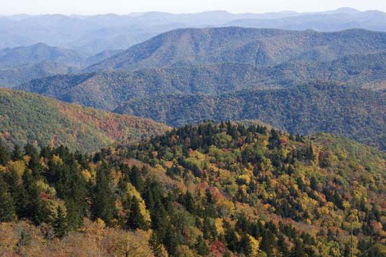
The relief of the mainland is diverse and relatively compact with mountains in the west and southeast and plains in the north and center. Most of the plains of the mainland formed on the ancient North American Platform; a vast flat area in the north formed within the Canadian Shield. The northern parts of the plains have pronounced traces of glaciation - hills, ridges. The chain of the Great American Lakes is, as it were, the boundary of the glacier. To the south are the Central Plains 200-500 m high, formed by continental and marine sediments. To the west of them are the Great Plains, which are a system of plateaus 500-1700 m high, with a flat surface divided by ledges. They are composed of sedimentary rocks of continental and marine origin. South of the Central Plains is Mississippi lowland up to 100 m high. This is a flat plain formed by river sediments, bordering the coast of the Gulf of Mexico. The Mississippi Lowland is crossed by numerous rivers flowing from the Central and Great Plains, the Appalachians and the Cordilleras.
Appalachians, located in the east of the mainland, are low folded-block mountains (up to 200 m) with wide valleys, plateaus and plateaus. The highest point is Mount Mitchell (2037 m). A distinctive feature of the mountains is the inversion relief, i.e., the external structure does not correspond to the tectonic structures that underlie the relief forms.
The main mountain system of North America - Cordillera stretched along the western edge of the mainland. Highest point - mountain McKinley(6193 m). This folded belt arose at the junction of two lithospheric plates - oceanic and continental. Active processes of mountain building are still going on here: frequent earthquakes and volcanic activity. The largest volcanoes Orisabo, Katmai. In the Cordillera, two chains of mountain ranges stand out: the Cordillera proper and the Rocky Mountains. Actually the Cordilleras are huge arcs that border the oceanic depression; ridges and plateaus here are crossed by tectonic faults. In the Rocky Mountains, post-volcanic phenomena are observed in the area yellowstone national park- geyser eruptions, thermal springs, mud volcanoes. Between the chains of mountain ranges, a system of plateaus and uplands is formed: the Yukon Plateau (within Alaska), the Fraser Volcanic Plateau (in Canada), the Columbian Plateau, the Great Basin, and the Colorado Plateau.
Climate.
The diversity of the climate of the mainland depends on its position in different latitudes. North America is located in all climatic zones, except for the equatorial one. Another important climate-forming factor is the relief of the mainland. Meridional large mountain systems contribute to the penetration of cold arctic air far to the south and tropical air masses to the north. In the inner parts of the mainland, a continental climate is formed. The climate is also influenced by ocean currents: cold - Labrador and California - lower the temperature in the summer, and warm - the Gulf Stream and the North Pacific - increase the temperature in winter and increase the amount of precipitation. However, high mountains in the west make it difficult for air masses to penetrate from the Pacific Ocean.

Within arctic climate zone are the northern margin of the mainland and most of the islands of the Arctic Ocean. In winter, the temperatures here are very low, snow storms are frequent, and cover glaciation is developed. Summer is cold, short, the air warms up to +5 °С. The average annual rainfall is less than 200 mm.
Subarctic climate zone covers the territory between the Arctic Circle and 60 ° N. sh. In the west, the belt extends below the latitude of Moscow. This is due to the influence of the Arctic Ocean, the cold Labrador Current and the northeast winds from Greenland. There are oceanic and continental types of climate. In winter, the temperature reaches -30 °C, near the coast of the oceans the temperature ranges from -16 to -20 °C. Summer temperatures are 5-10 °C. The amount of precipitation varies from 500 mm per year in the east to 200 mm per year in the west (Alaska region).
Most of the mainland is located within temperate climate zone .
It distinguishes three climatic regions:
- region temperate maritime climate in the west of the mainland (the Pacific coast and the western slopes of the Cordillera). Westerly transport dominates here: winds bring a large amount of precipitation from the ocean - up to 3000 mm per year. The average temperature in January is up to +4 °С, the average temperature in July is up to +16 °С;
- region located in the central part of the belt. It is characterized by relatively warm summers - from +18° to +24°С; cold winter - up to -20 ° С. The amount of precipitation in the west is up to 400 mm, but their amount increases to 700 mm in the east. The practically open space of this part of the mainland is subject to the invasion of air masses from both the north and the south. Therefore, atmospheric fronts are frequent here, accompanied by snow storms in winter and showers in summer;
- region temperate continental climate distributed along the east coast of the Atlantic Ocean. In winter, cyclones are frequent here, bringing a lot of snow; temperature from -22 °С in the north to -2 °С in the south. Summer is not hot - up to +20 ° С; the cold Labrador current has its influence. The amount of precipitation is different, depending on the relief and distance from the ocean, but on average - 1000-1500 mm per year.
Subtropical climate zone located on the territory from 40 ° N. sh. to the coast of the Gulf of Mexico. The territory also has a large extent from west to east, so there are differences in climate types and the following climatic regions are distinguished:
- in the West subtropical mediterranean climate with warm and humid winter: temperature +8 °C, rainfall up to 500 mm per year; and dry, cool summers: temperature +20 °С - the cold California current has its effect;
- region subtropical continental climate located in the center of the climate zone. Characterized by high temperatures in summer and low rainfall throughout the year;
- region humid subtropical climate covers the Mississippi lowlands. Summer temperatures up to +30 °С, mild winters up to +5 °С.

South of 30° N. sh. located tropical climate zone , it is hot all year round. On the east coast of the mainland and on the islands, there is a large amount of precipitation brought by the trade winds. The California Peninsula has a dry tropical climate.
Subequatorial climate zone located on the narrowest southern part of the mainland. Here, typical for this climatic zone, high temperatures during the year are about +25 °С. Winds from the Pacific and Atlantic oceans bring a lot of moisture - up to 2000 mm per year.
Land waters.
North America has large full-flowing rivers, numerous lakes and significant groundwater reserves. In terms of annual runoff, the mainland is second only to South America. The river network is unevenly distributed over the mainland, and the rivers have different types of food.
The main river system of the mainland Mississippi with inflow Missouri has a length of 6420 km, and carries its waters to the Gulf of Mexico. The river basin includes the Rocky Mountains, the Appalachians, the Central and Great Plains. The river is full-flowing all year round and has snow and rain types of food. The rivers of the Pacific basin have a large steepness of fall, so they are turbulent, rich in hydropower. Among them are large rivers Colorado(2740 km) and Colombia(2250 km). River Yukon in northwestern Alaska, it is full of water in the summer, during the snowmelt period. The largest river in the Arctic Ocean basin Mackenzie 4250 km long originates in the Great Slave Lake.
Most of the lakes in North America are located in areas that have undergone glaciation. The most unique system great lakes- Upper, Huron, Michigan, Erie, Ontario - the world's largest accumulation of fresh water on land. Most of the lakes are of considerable depth, for example, Lake Superior is almost 400 m deep. Lakes Erie and Ontario are connected by the Niagara River. Cutting through a hilly ridge, the river overthrows the Niagara Falls, 50 m high and 1 km wide.
Major lakes in North America are also Winnipeg, Great Slave, Great Bear, Athabasca. Residual lakes have been preserved in the basin of the Great Basin - the Great Salt, Utah.
Summary of the lesson “North America. Relief and climate.
Next topic:
It is located on two: North American and Caribbean. The largest of them is the North American Plate, on which almost the entire continent is located, as well as islands, including. It should be noted that the western boundary of the plate passes through the territory in such a way that the northern tip of Russia is geologically also part of North America. The Caribbean plate includes the south of the continent, as well as the islands. Tectonic activity is most pronounced here, as there is an active collision of the plate with the North and South American plates.
The northern part can be divided into three parts: the western mountainous, ancient platform and the eastern, related to ancient folding. The western one was formed mainly in the Mesozoic and includes the Cordillera, some of its sections continue to form today. The platform includes Greenland, the Canadian Shield, Labrador, the Center of North America. Ancient folding refers to the Hercynian age and is represented by the Appalachians, the Atlantic and Mexican lowlands.
The most tectonically active regions of America are located in its western - from the Aleutian Islands to the Isthmus of Panama. Most of the volcanoes are also located here, many of them remain active, such as: Momotombo, Tahumulco, Orizaba, Popocatepetl, Colima, Shasta, Rainier, Sanford and Velyaminov Volcano in Alaska. There is also a number of tectonic faults, in the area of which there is a constant threat of earthquakes. The most famous of them is the San Andreas Fault. The danger of this fault lies in the fact that large cities of the United States are located next to it - primarily San Francisco and Los Angeles. Devastating earthquakes have already happened here before, however, over the past decades, cities have grown significantly, so that new ones of this kind in our days will lead to colossal destruction. Another dangerous is a dormant volcano on the territory of the first national park - Yellowstone. Today, the volcano manifests itself only in the form of more than three thousand geysers in the park, which is the most beautiful and unique monument of nature. One of the most famous geysers is the geyser (Old Faithful), which has been erupting on average every 90 minutes for many years (pictured). However, according to the forecasts of geologists, in the event of the awakening of the Yellowstone volcano, an explosion will occur that will exceed the power of the eruption of Krakatoa, and the consequences of this eruption will be reflected on the entire planet. Fortunately, such cataclysms occur on Earth no more than once every several tens of thousands of years. As noted above, the islands of the Caribbean Sea are also characterized by very high seismic activity. Last scary
summary of other presentations"Mineral Resources of North America" - Atlantic Ocean. Minerals. M A g m a t i c h e s k e. Development of the mine. Mississippi Nism. Relief and minerals. Mexican Nism. Sedimentary rocks. Gold mining. Tectonic map of North America. Appalachian mountains. About with and d about chnye. Canyon Colorado. Relief and minerals of North America. Bingham copper mine.
"Characteristics of the natural zones of North America" - Soils of the Arctic deserts. Indicate the natural zone of North America, where the soils are chestnut and chernozem. Features of the placement of natural areas. Tests. Taiga. natural areas of North America. Taiga plants. The climate of the Arctic deserts. Broad-leaved forests. Plants of deciduous forests. Mixed forests. Navigation guide. Steppes. Taiga animals. Desert animals. Plants of the arctic deserts.
"Characterization of the Inland Waters of North America" - Source of the Mackenzie River. Rivers flowing down the eastern slopes of the Appalachians. Rivers of North America. Slave lake. Mississippi. Mississippi with a tributary of the Missouri. Lake Athabasca. Bear. Niagara River. Inland waters of North America. Large rivers. Length. There are many lakes of volcanic origin in the Cordillera. Lakes in the north of the mainland. The largest rivers in the Pacific Ocean. Great American Lakes. Great Lakes.
"Inland Waters of North America" - The largest rivers of the Pacific Ocean are the Columbia and the Colorado. Lake Ontario. The Great Lakes form a huge water system. In the north of the mainland is the Mackenzie River. The Columbia River is a beautiful mountain river. Lake Erie is the smallest of the Great Lakes. Bear. The Colorado River forms the Grand Canyon. Analyze the atlas map and answer the questions. Which ocean basins are the rivers of North America.
"Relief of North America" - Working with the map. Coastal ridges. To get acquainted with the structure and relief of North America. Let's remember. We count and compare. We work with text. Orizaba and Popocatepetl. Cordillera. Geological structure. Let's move on to verification. Mountain differences. Scheme. Contour map template. Geological structure and relief. Relief of North America. Relief. The study of the features of the relief. Great Plains. Appalachians.
"Rivers and lakes of North America" - Lake Managua in Central America, in Nicaragua. The area is 19.5 thousand km2. Colombia belongs to the Pacific Ocean and is fed by melt water from glaciers. Michigan is the largest lake within the United States. Lawrence. Depth up to 236 m. The area of its own catchment area is about 90 thousand km2. Erie is a lake in North America, the southernmost in the Great Lakes system. Lake Nicaragua is the largest fresh water reservoir in Latin America.
The landscape of North America was formed under the influence of many geological processes. Some of them continue to this day. What are the features of the relief and its specificity - the material presented will help answer these questions.
Relief of North America
The relief of North America is diverse and contrasting. The mainland lies on the lithospheric plates - North American and Caribbean. The western border of the last plate passes through Eurasia.
In the central region there are flat plains, which alternate with vast expanses of hilly type. In the east, they are adjacent to the Appalachian Mountains. In the west, the plains are adjacent to the mountain ranges of the Cordillera.
The features of the relief of North America are due to the specifics of the geological development of the territory, which is 4.5 billion years old.

Rice. 1. Relief map of North America
The peculiar foundation of the continent is the ancient North American plateau, whose relief is expressed by plains differing in height, the shapes and outlines of which resemble waves.
TOP 4 articleswho read along with this
External processes played a central role in the formation of the relief. Many millennia ago, the areas that are located in the northern part of the mainland were a glacier.
The glacier that existed at that time was twice the size of Australia, and the power was such that this giant easily polished the surface of the rocks and leveled the ground under him.
The following factors influenced the formation of the landscape:
- impact of surface and ground waters;
- wind.
The structure of the relief of North America
The structure of the continental surface is divided into the following parts: northern and central, where the plains are located, eastern - with the Appalachian mountains, and western - with the Cordillera. This is the largest mountain system in the world.
In the northwestern part of the mainland, large landforms of North America are represented by mountain ranges that reach maximum heights. Mount McKinley (6193 m) located here is the highest point of the Cordilleras and North America.

Rice. 2. Mount McKinley
Together with the South American Andes, these heights make up the longest mountain chain in the world - over 18 thousand km!
Mountain building in the Cordillera is continuous. This is indicated by the constant activity of volcanoes, which is accompanied by frequent earthquakes. Active volcanoes here are:
- Orizaba (5700 m);
- Popocatepetl (5452 m);
- Colima (3846 m).
Seismically active parts of the mainland are located on the western and Pacific coasts.

Rice. 3. Volcano
Plains formed on tectonic plates and occupy two thirds of the surface. South of the Laurentian Upland stretch the Central Plains with average heights of 200-300 m. To the west of the Central Plains, the Great Plains stretch along the Cordillera. The surface is dotted with river valleys and ledges into separate massifs and plateaus.
To understand what the relief of North America is, you need to have an idea about the course of processes affecting the surface of the platform, which has been destroyed and leveled many times.
What have we learned?
From the article on geography (Grade 7), we learned what factors influenced the features of the relief of North America. What natural processes take place in this area. Which part of the mainland is occupied by mountains, and which by plains. Why mountain building is a constant and continuous cycle. We also managed to obtain information about the age of the territory on which the mainland is located. It was possible to find out what explains the diversity and contrast of the relief characteristic of this territory. We clarified the location of the highest peak of the Cordillera and North America.
Topic quiz
Report Evaluation
Average rating: 4.5. Total ratings received: 179.
Relief - all this is studied today at school in geography lessons. Knowledge of these topics is necessary not only for passing the exam, but also for general development. After all, each of us must understand what the surface of the planet on which we live is.
North America, the relief of which we will consider in this article, resembles South America in the type of vertical dissection. A powerful belt stretches along the western coast for 7000 km. The eastern half of this mainland is predominantly flat. All this allows us to say that the relief of North and South America has a significant similarity. However, there are significant differences between these continents. In particular, the Cordillera as a mountain system is much wider and more complex than the Andes (also called the Andean Cordillera). They consist of a whole system of ridges that differ in tectonic and geological structure, which are isolated.
Eastern Belt
5 orotectonic longitudinal belts are clearly distinguished almost along the entire length of the Cordillera. The first of them, the eastern one, is the ranges of the Laramian folding: the Mackenzie Mountains, the Brooks Range, the Eastern Sierra Madre Range, the Rocky Mountains. The latter can be divided according to the features of orography into two parts: southern and northern. Between them, the Yellowstone Plateau acts as a border. The clear straightness of forms is a striking orographic feature.
Front Range of the Rocky Mountains
The front range of the Rocky Mountains (North America) has the following relief: it stretches for almost 2000 km in a straight line, striking with the continuity, integrity and uniformity of its geological structure. The mountain range, distinctly expressed, is crowned with steep high peaks, the height of which reaches 4000 m. It gradually descends in the east to the Great Plains. The front range in the west is limited by a tectonic fault in the northern part. In the middle part of the mountain are lowered. They are crossed by the Peace River, which is one of the sources of the Mackenzie River. The front range in the southern part is expanding. It is divided into separate ranges, the height of which is significant: Lewis, Caribou, Selkirk. In this part, the largest peaks of the Front Range are located. These are Mount Robson (height 3954 m) and Mount Columbia (3747 m). The alpine landforms of North America are typical of the Front Range. It is also characterized by impassability and significant glaciation.
Rocky mountains in the south
The Rocky Mountains do not form a single mountain range in the southern part. Here they consist of separate massifs, sometimes isolated and separated by "parks" - wide basins, which are plateau-like areas that connect the Great Plains with the Great Basin. Some of the ridges (Sangre de Cristo, Wasatch) stretch almost from north to south. Others (for example, Yuinta) - in a west-east direction, perpendicular to them. The significant height and width of this mountain belt compensates for the lack of continuity. The border between and the Rocky Mountains is very clearly defined: a steep wall is a mountain slope. The southern segment is typical epiplatform mountains, which were formed after the activation of the edge of one of the ancient platforms.
Belt of internal plateaus and plateaus

The next is a belt of internal plateaus and plateaus formed in the Nevadian folding on the mainland of North America. The relief is characterized by folded Nevadian structures represented by peniplains. Within this belt there are also plateaus that are confined to the "fragments" of the ancient North American platforms and are sandwiched by the Cordillera ridges (Northern Mass, Colorado Plateau). The largest intermountain plains: Fraser, Yukon, Great Basin, Columbia, Northern and Central Mass, Colorado.
Big Pool
The Great Basin is a denudation plateau, the largest in area. This territory, the width of which reaches 800 km, as a whole is an alternation of plain and mountainous surfaces, with the former predominating. On average, the surface of the plateau is raised by 1500 m. However, the height fluctuations are large. The plateau is crossed by parallel ridges with heights of about 3 km (Wheeler Peak - 3982 m). Deep depressions called bolsons lie between them. These are semi-closed and closed basins, which are areas of internal runoff. Death Valley is one of them (-85 m).

Remnant peaks are often found here (including the cones of volcanoes).
Colorado Plateau and Grand Canyon
This is one of the unique corners of our planet that North America is famous for. Its relief is very beautiful. In its geological structure (undisturbed horizontal plates of sedimentary rocks of different ages - from the Upper Paleosian to the oldest, lying on a crystalline basement), this plateau is similar to the North American platform. Its surface is a hilly plain, the height of which reaches 3860 m.
The attraction of the plateau is the Grand Canyon (North America). The relief and climate attract many tourists to this place. The Grand Canyon (pictured below) was formed along the Colorado River, in its middle course. Its depth reaches 1800 m, with a width of 8 to 25 km at the plateau level and up to 1 km at the bottom level. Steep slopes of an interesting, bizarre shape are characteristic of the Grand Canyon. They arose as a result of processes of erosive destruction and weathering. A winding narrow channel is cut into the crystalline base.

Inner mountain belt
The third belt - the inner mountain - is the belt of the Nevadian ranges: the Coast Range, the Alaska Range, the Cascade Mountains, the Sierra Nevada, the Transverse Volcanic and Western Sierra Madre. These mountain ranges are distinguished by straightness. Igneous rocks predominate in their structure. - a batholith with volcanic cones impaled on it. The Sierra Nevada Range is an asymmetric giant crystalline batholith with gentle western and steep eastern slopes.
Synclinorium belt
The fourth belt is the synclinorium belt. This is a zone of subsidence, which took shape in the Neogene. Part of it is currently represented by various sea bays and straits. On land, this is Death Valley, the Great California Valley, the lower reaches of the Colorado River.
Extreme western belt
The fifth belt is the extreme western one. This is the coastal belt of such ranges as the Aleutian (there are 25 active volcanoes), the Kenai Peninsula, the Island Range with Victoria Peak (altitude - 2200 m), the Chugach Range, the Victoria Peninsula, the Coast Ranges, the South Sierra Madre Range. All of them are medium-altitude, only the most prominent peaks are higher than 2 km.

Depending on the degree of glaciation, the severity of orographic longitudinal belts, tectonic and erosional dissection, the Cordilleras are divided into 4 morphostructural regions: the Cordillera of Mexico, the Cordillera of the USA, the Cordillera of Canada and the Cordillera of Alaska.
Eastern part of the mainland
What is the relief in North America in the east? Let's figure it out. As we have already noted, the landforms of North America are mostly flat in the eastern part of the mainland. Basically, these are elevated (Central, Laurentian) and high plains. The low-lying ones are located along the coastline: the Mexican, the Atlantic, the Gudson, and also the Mississippi in the lower reaches of the river of the same name.
Appalachian mountain belt

In North America, in contrast to South, another mountain belt stretches along the east coast - the Appalachian. This is a system of mountain ranges located from the Gulf of St. Lawrence to about 33-32 0 s. sh., that is, almost 2300 km. is the northern link. The Appalachians are epiplatform mid-altitude mountains. A significant difference between the southern and northern parts of this mountain system determined the features of the tectonic and geological structure. The Hudson Graben is the boundary between the Southern and Northern Appalachians. The northern Appalachians as a whole are undulating plateaus. Individual mountains, ridges or mountain ranges rise above it. The northern Appalachians were covered by the Quaternary glaciation. Therefore, the shapes of the mountains now are gentle, only on the highest peaks there are circuses with sheer walls.
Southern Appalachians
The Southern Appalachians are distinguished by the alternation of long parallel valleys and ridges. Plateaus stretch along the foot of the mountains from the east and west. This is Piedmont in the west - a denudation flat plain, which is formed by early Cambrian crystalline rocks. From it, in the west, a chain of mountain ranges rises steeply, almost continuous (Kokhuta, Unaka, Cherny, Smoky, Bolshoi, Blue, etc.), the height of which is 1-1.5 km. These are "ancient mountains" - dense cores of Caledonides, dissected by denudation.
Belt of ridges and valleys
One of the most remarkable regions of the Appalachians is located to the west of them. These are the so-called Young Mountains, or the Belt of Ranges and Valleys. Here are some interesting features of the relief of North America. The entire territory is composed of sedimentary rocks of the Paleozoic times: ridges - shale and sandstones, valleys - dolomites and limestones. Elongated for hundreds of kilometers from the southwest to the northeast along the line of the strike of the mountains, wide valleys alternate with flat-topped or narrow ridge-like ridges. At an altitude of 500-600 m lies the bottom of the valleys. The tops of the ridges reach 1-1.2 km. Valleys in tectonic terms are anticlinoria, and the ridges are synclinoria. That is, in this place there is a clear discrepancy with the type of tectonic structure of the modern form, which the relief of North America has here. A photo of the Appalachians is presented below.
This is an example of an inverted or inverted terrain type. It is quite rare in the mountains and is most pronounced in the Appalachians. This type of relief, by analogy, became known as the "Appalachian relief". The belt of "young mountains" interrupts the Appalachian Plateau (Cumberland, Allegheny) from the west. It is a ledge, the height of which is 300-400 m. This plateau is significantly higher than Piedmont. Its surface at the eastern edge lies at an altitude of about 1.2 km, and at the western edge - 500 m. The plateau is deeply dissected in places by valleys of various rivers (gorges with narrow bottoms and steep slopes).
Well, now that the relief of North America has been briefly discussed in this article, we hope it will be easier for you to form your own idea about it.
