The article contains information that explains the peculiarity of the geographical position of the black continent relative to other continents. The material points to unique features that are unique to this area. Supplements information from the geography course for grade 7.
Geographic location of Africa
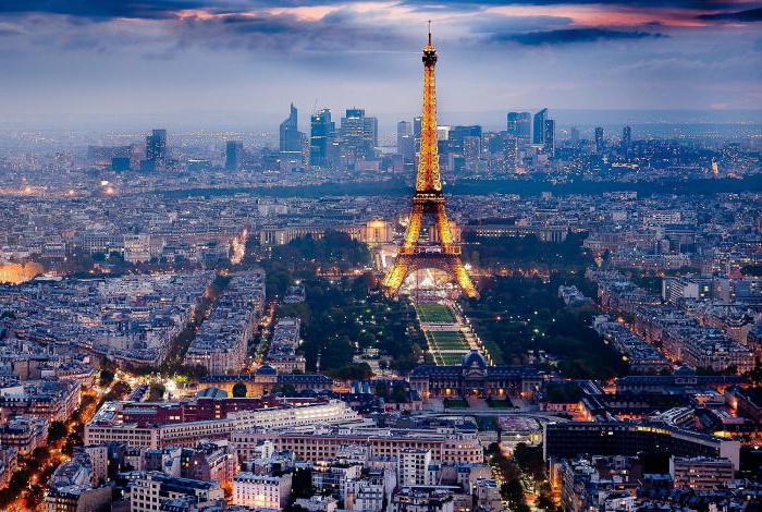
The black continent is recognized as the hottest continent on the planet. This is due to the fact that it runs on both sides of the equator. It conditionally cuts the continent in the center. This position of the land area has become objective reason the fact that the territory receives a significant amount solar energy needed to sustain life. The size of the territory from north to south is 8 thousand km, from west to east in the northern tip - 7.5 thousand km.
The mainland is washed by two oceans and two seas at once - East End- the Red Sea and Indian Ocean, western - Atlantic Ocean, and from the north - the waters of the Mediterranean Sea.
The mainland is distinguished from other features, which consist in its weak dissection in the vertical and horizontal plane. Geographical position Africa is specific, since the continent is located symmetrically with respect to the equator.
The location of the continent is such that it is located between two tropics: the extreme northern tip 37°20” N. sh. - Cape El Abyad, extreme southern tip 34°5”S sh. - Cape Agulhas.
TOP 4 articleswho read along with this
Surprisingly, the main part of the mainland lies in the hot zone. The entire area is regularly heated by the sun's rays.
The physical and geographical position of the mainland is contained in the fact that its northern region much wider than the south. The width of the southern part is about 3,000 km, and the length from the western tip of Cape Verde to the eastern point of Ras Hafun is only 7.5 thousand km.

Rice. 1. Map of the natural zones of Africa.
Africa relative to other continents
Due to the extraordinary configuration of the mainland, the location of natural areas is different. But this is offset by their transition into each other.

Rice. 2. Scheme of the transition of climatic zones.
The position of Africa relative to other continents is such that it is located almost in the very center of the world map. Other continents are located along different sides Sveta.

Rice. 3. Position of Africa on the map.
A characteristic feature of the continent is the ability to "mirror" the entirety of its natural diversity. Due to the fact that the equator cuts the mainland in the center, its natural zones, which are located in the northern part, reflect the zones that are in southern region from the equator. It turns out that, passing from Cape Town to Cairo, you can observe each of the natural zones African continent twice. None of the continents of the earth is endowed with such a unique feature.
When drawing up a plan for describing the geographical location of Africa for a geography lesson, you need to consider such points as:
- The orientation of the mainland relative to imaginary contours on the map: the equator, the tropics, the polar circles, the poles of the earth, the prime meridian.
- Placement in the hemispheres of the planet.
- Names of the extreme continental extremities and their coordinates.
- The size of the territory from north to south in degrees and kilometers.
- The size of the territory from west to east in degrees and kilometers.
- Orientation of the continent in zones and regions of climate.
- The orientation of the mainland relative to the seas and oceans that wash it.
What have we learned?
We learned that thanks to the physical and geographical specific features continent, each of its natural zones can be observed twice. We found out that the equator line literally divides Africa into two halves. We have established the reason why this territory is recognized as the hottest part of the land on Earth. Familiarize yourself with the plan detailed definition(through description) of the geographic location of the mainland. Established the differences between the natural zones of the black continent from each other.
Topic quiz
Report Evaluation
average rating: 3.9. Total ratings received: 124.
The main differences between these courses and the previous ones are as follows:
- Here for the first time scientific definition concept of geographic location. Textbooks fully reveal its content, including signs of position relative to other objects and mathematical lines.
- At the same time, two interrelated concepts are being formed - “geographical position” in general and “geographical position” of a specific territory - Africa, Australia, the Urals, West Siberian Plain etc. This approach increases the awareness of knowledge, provided that the teacher repeats the content of the Concept throughout the course.
- In grades VI-VII, it is carried out mainly education independent description of the geographical position of the territory. It goes along with the formation of the corresponding concept. —
- Starting from grade VI, students use special plans for describing the position on the map. They gradually change along with the complication of the concept: new objects are added that affect the nature of the territory, with respect to which the position should be determined!
At the same time, the independence of schoolchildren is increasing. Assimilated reception acquires greater flexibility. So, when describing the geographical position of the West Siberian Plain in 7th grade many students determined its position relative to the Central Siberian Plateau.
Thus, the new learning conditions require:
- more purposeful formation of the concept of "geographical position";
- learning to receive a description of the geographical position on the map based on the concept being formed;
- more detailed and independent descriptions on the map;
- the widespread use of knowledge about the features of the geographical position to explain the natural conditions of the studied territories, i.e., transferring the technique to new material.
Description of the geographical location in the VI class.
The concept of "geographical position of the mainland" is introduced deductively, like a number of others. general concepts in the 6th grade. The learning process in the "Africa" section goes according to the following plan:
- The purpose of studying the geographical position of the mainland.
- Disclosure of the content of this concept.
- Setting the objectives of the lesson:
- a) find out the main features of the geographical position of Africa;
- b) learn to independently describe the position of the mainland on a physical map.
- Exploring the geographic location of Africa: reporting and recording a plan for describing the geographic location of the mainland. Conversation according to plan and physical map.
- The study coastline Africa. (Information about it is not included in the concept of "geographical location", but is studied together.)
This sequence is largely preserved when considering subsequent continents, as well as in the course physical geography USSR.
Information about the meaning of the study of the geographical location and the content of this concept provide awareness of the method being formed. In the textbook on the geography of the continents, the content of the concept is set out with the help of a description of the actions that must be performed in order to find out the geographical position of the mainland. For an example of the dependence of natural conditions on the position of the territory on earth's surface the teacher reminds schoolchildren of the connection between the amount of heat received by the Earth and geographic latitude, and the amount of precipitation often depends on the proximity or distance from the oceans.
Setting the objectives of the lesson to the students helps to realize the direction cognitive activity students, the result that should be obtained in the learning process.
A typical plan for describing the geographical position of the mainland has the following content:
- Mainland size.
- The position of the mainland relative to the equator (tropic, polar circle), the prime meridian.
- Extreme points of the mainland and their coordinates. Length from north to south and from west to east in degrees and kilometers.
- Oceans and seas surrounding the mainland.
- Proximity to other continents or remoteness from them.
Information about the size of the territory is not included in the content of the concept, but in educational purposes are considered together (not necessarily at the beginning).
According to the written plan and map, the conversation begins:
- Look at the map of the hemispheres. Which continents is superior to Africa in terms of its territory, and which is inferior to?
- Open from 6 textbook. Determine the area of Africa from the diagram.
- How many times the area of Africa more area Antarctica?
- Where in Africa does the equator pass? Northern.and Southern tropics? Draw a conclusion about the possible climate of Africa:
- How is Africa located in relation to the prime meridian?
Then the teacher shows the extreme northern and southern points of Africa and suggests determining their latitude. He emphasizes that this is necessary to determine the extent of the continent in degrees and kilometers. Next, students will learn the extent of Africa between the extreme western and eastern points, taking into account the map of the hemispheres of the atlas about the value of one degree of longitude at latitudes 10 and 20 °. Such data is placed at the exit of the parallels on the map frame.
It must be taken into account that in school geography There are two ways to measure the length of the continents. Their use depends on the learning environment.
The length of the mainland can be found by the difference in latitude or longitude between the extreme points. It's over hard way, since the extreme northern and southern points usually lie on different meridians, and the extreme western and eastern point- on different parallels. Given this, the length of the continent is often measured not by its extreme points, but by some meridian or parallel. Provided that students are well prepared, it is useful to determine the length of the mainland between its extreme points.Next, students name the oceans and seas; washing the mainland, while orienting maritime boundaries on the sides of the horizon, indicate the proximity of Africa to Eurasia and remoteness from other continents.
At the beginning of grade VI, students cannot simultaneously master both the content of actions and their sequence. They pay attention only to the content of the actions. Therefore, at the end of the conversation, it is useful to ask: according to what plan did we describe the geographical position of Africa? Students do not see the features of the geographical location of the mainland that affect its natural conditions. The teacher emphasizes that Special attention you need to pay attention to those features of the geographical location on which the natural conditions of the mainland depend, and then name these features. In the "Africa" section, they have not yet been considered, so the teacher makes the appropriate conclusion. In the future, students cope with this task more successfully. And in the course of the physical geography of the USSR, the identification of the features of the geographical position becomes the main content of work on the map.
To form a method for describing the geographical location of any territory, and not just the mainland, it is useful to complete the task of the textbook - to describe the geographical location of Madagascar. The teacher points out how to change the plan written down by the students, suggests finding out the position of the island in relation to Africa. In the context of the material-rich first lesson on Africa, students can complete this task at home or when checking homework in the next lesson. This is how learning to transfer the formed technique to new material begins.
The next exercise in describing the geographical location of the mainland is performed when studying Australia. Depending on the preparedness of the class, students can describe the geographical location of Australia in general or. grouped: plan items for two tasks.
Comparison is a good means of identifying features of a geographical location. It is possible, for example, when studying Australia and Africa, South America and Africa, the continents northern hemisphere. Considering that at this stage detailed comparisons are of great difficulty, it is necessary to compare the continents not as a whole, but by individual elements of their position. So, a comparison of the geographical position of Africa and South America is possible on the following issues:
- What is the difference in the position of Africa and South America in relation to the equator, the northern and southern tropics?
- Which continent is located to the north? south? Prove your conclusion using the geographic coordinates of the extreme points.
- Which continent is most elongated north to south?
- How the difference in geographical location should affect the climate and natural areas South America?
- What is common in the geographical position of both continents?
As can be seen, the comparison covers the most significant aspects of the geographical location that affect the natural conditions of the continents.
Learning to describe geographic location continues when considering natural areas continents. Depending on the study time, these descriptions are of varying detail and are sometimes quite concise. In the same time assignments are needed requiring to associate a geographical location with various components of nature, for example:
- What is the relationship of geographic location Northern Australia with its temperatures, amount and mode of precipitation?
- Which continent - South America or Africa - has a more varied climate? What are the reasons for diversity?
As learning progresses, the cognitive independence of students. increases. Increasingly, students are using the technique as a means of educational cognition. By the end of grade VI, students can name significant aspects of a geographical location without relying on a written plan.
Text Education for all:
To find an object on the map, you need to know it geographical description. Even when it comes to such large geographical objects, like continents, you may need, for example, for a geography lesson at school, describe in detail and indicate its location on the map. If you need to compose general description or determine the geographical position of the mainland, follow simple tips and you will succeed.
You will need
- - paper or electronic card;
- - paper and pen.
Instruction
Take a regular paper or electronic map of the world with coordinates and find the mainland you need. If you don't have a card, you can find it in general search by typing the name of the continent and using the "maps" menu.
See how the position of the mainland relates to other continents, the equator, the northern and south poles in which hemisphere is the mainland, for example, North America located in the northern hemisphere, and Africa crosses the equator. Describe it in as much detail as possible.
Carefully study the coordinate grid and find the coordinates of the mainland: the northernmost (upper), southern (lower), western (right) and eastern (left) points. To find the coordinates of a point, find the latitude and longitude.
Latitude is measured from the equator, if you go up from the equator, then the latitude value will be positive, if you go down - negative. It is impossible to determine the exact value on a paper map, estimate approximately according to the drawn parallels (horizontal lines). That is, if your point (for example, Cape Agulhas is the most south point Africa) lies between the parallels 30° and 45°, divide this distance by eye and determine about 34° - 35°. For more exact definition, use an electronic map or geographical atlases.
Longitude is measured from the prime meridian (this is a vertical line through London). If your point lies to the east of this line, put a "+" in front of the value, if to the west, put a "-". In the same way as latitude, determine longitude, only not by horizontal, but by vertical lines(meridians). Exact value can only be found on an electronic map or with the help of a sextant.
Record the coordinates of all extreme points of the mainland in the form (latitude from -90° to +90°, longitude from -180° to +180°). For example, the coordinates of Cape Agulhas will be (34.49° south latitude and 20.00° east longitude). The modern notation of the coordinate system means notation in degrees and decimal fractions, but measurement in degrees and minutes used to be popular; you can use either system of notation.
Describe the features of the mainland, its highest and lowest point above sea level, the longest and wide rivers, large lakes washing the mainland of the sea, the states located on its territory and other information.
Not only studying natural features different regions is engaged in the science of geography. Description of the country, its climate, population, economy and state structure- is also among the subjects of research in this discipline. How are states studied? What does a country description plan look like? You will learn about this from our article.
How to describe a country?
Geographers describe countries in roughly the same way. It includes a description of nature, population, economy and government. The country description plan assumes the following items:
- geographical location (territory area, length of borders, coordinates of extreme points, availability of access to the sea, number of neighboring countries and overall score profitability geopolitical position state);
- natural features of the territory (climate, relief, inland waters, organic world etc.);
- the capital and administrative-territorial structure of the state;
- population of the country (total size, density, distribution, ethnic, religious and linguistic composition);
- the country's economy (main specialization, leading industries, level of development Agriculture, volume and other economic indicators);
- features of the political structure (parliament, president, government).
The country description plan may also contain information about cultural characteristics, tourist attractions, currency, official symbols of the state.
Geographical position of the country
Any plan to describe a country should begin with where the country is located. That is, it is necessary to provide information about in which hemisphere and on which continent the state is located, what is its area and the total length of the border. The coordinates of the countries are determined by the extreme points: northern, southern, western and eastern. Based on this information, it is possible to determine total length the territory of the state from west to east, or from north to south, as well as to evaluate its general configuration (compact or elongated in a certain direction).
It is important not only to describe the geographical position of the country, but also to assess its economic benefits. Therefore, it is extremely important to indicate which states the country borders on, whether it has access to the sea, large navigable rivers whether it is located at the intersection of important transport corridors. Each of these aspects greatly affects the economy and the overall well-being of the country.
Natural conditions and resources
The second point of the country description plan is the nature features of a particular territory (geomorphological, climatic, etc.).
The country's climate is extremely importance for her economic development. So, the ideal location of the state is in a moderate climate zone(between 45 and 65 degrees). In this zone, the most optimal conditions for human life and agriculture.

The relief of the territory of the country also affects its well-being. It is no secret that on flat terrain it is much easier to build cities, lay roads, and create large industrial complexes. Incidentally, the most ancient famous cities the world arose precisely on the plains, off the coast of the seas or large rivers.
Population of the country
The population of a country is also an important aspect for its comprehensive study. When describing it, it is necessary to indicate total number inhabitants, population density, characterize demographic situation and so on.
Important indicators are also mortality, life expectancy in the country, and the level of infant mortality. Most economically developed countries are characterized by a low birth rate, low mortality and a significant life expectancy. In the developing countries of Asia, Africa and America, on the contrary, there is a high birth rate, high mortality and low overall life expectancy.

An important aspect in the characterization of any country is the ethnic, linguistic and religious composition its population. All states of the world are divided into two groups: mono-ethnic (in which one nation predominates) and multi-ethnic (which are a kind of "mix" of ethnic groups and nationalities).
State economy
The main indicators of economic development include the following:
- volumes of GDP and GNP per capita;
- income level of the population;
- competitiveness of goods and services produced in the country;
- cost and quality of labor;
- the level of corruption;
- the level of modernization of production, etc.
According to these indicators, all countries of the world are divided into several groups. There are economically developed countries (Japan, USA, Canada, Australia, South Korea, Germany, France and others), developing countries(Myanmar, Chad, Bolivia, Bangladesh and others), as well as (Russia, Ukraine, Belarus, Kazakhstan, etc.).
According to the structure of industrial production, all states are also divided into:
- industrial;
- agricultural;
- industrial and agricultural;
- postindustrial.
The political structure of the country
The state is a special organization complex structure designed to govern society. All countries in the world are usually divided into three groups:
- unitary - those that are controlled from one center (examples: Romania, Ukraine, France, Norway, etc.);
- federal, consisting of several separate subjects - states, lands, republics (examples: Russia, USA, Germany);
- confederations are temporary unions of two or more states.

According to the form of government, monarchy countries (in which all power belongs to one person and is inherited) and republics (in which the majority is the main source of power) are distinguished. Monarchies can also be absolute (the power of the monarch is unlimited), parliamentary (the power of the monarch is limited by parliament) and theocratic ( sovereignty belongs to the Church). The only example modern on the planet is the Vatican.
The country's policy is determined by the system of methods and techniques with which it implements the fullness of its power. Based on this thesis, political regime This or that state can be legal (democratic), totalitarian or authoritarian.
Countries and their capitals
The capital is the main (not necessarily the largest) city of the country, in which the government and other important bodies are located. state power. The word itself comes from the Old Russian "(pre)stol", which means "throne". The popular expression "the capital city of Kyiv" is connected with this etymology.
The choice of the capital is always a dilemma for the state. After all, two or more can claim the role of the main city. major centers. In the Austro-Hungarian Empire, for example, this problem could not be solved. Therefore, there were two capitals at once - Vienna and Budapest. In some states, the capital was created and built practically "from scratch" (an example of such a state can be the United States of America with its capital in the city of Washington).
Countries and their capitals are often perceived as one entity. However, do not forget that the title of the "main city" in the state may change. So, in 1997, the authorities of Kazakhstan moved the capital from Alma-Ata to the city of Astana.
Another one interesting capital on the world map - this is Jerusalem. This city is the capital at the same time for two countries - Israel and Palestine.
Flag - as the main symbol of the state
The flags of the countries of the world differ from each other not only in color or pattern, but also in their proportions (width and length of the cloth). All flags of world states have traditional form rectangle (less often - a square), with the exception of only one - Nepalese. The banner of this country is presented in the form of two equal triangles.

The flags of the countries of the world are different in their colors. And each color has its own symbolic meaning for a particular state. White, as a rule, symbolizes peace and prosperity, while green - significant natural wealth.
Quite interesting in heraldry is black. It would seem that it should be mourning. However, it is not. Black color is quite often present on the cloths of African states. And there, as a rule, he symbolizes the black population of a particular country.
Designation of the currency of different countries
Everyone has their own money, of course. How is carried out by different countries?

One or the other state currency denoted with special mark(symbol). It can be an alphabetic index (abbreviation), a numeric code, or a special grapheme. These signs are called upon in an abbreviated form, concisely and in an original way, to designate certain currencies.
Monetary units began to be depicted with special symbols in antiquity. Below are the graphemes of the most famous world banknotes:
Finally...
One of the tasks of geography is an objective, comprehensive and reliable study of world states. The country description plan should contain the following items: geographical location, natural conditions and resources, population, capital, administrative and political device, economy, currency and State symbols(flag, coat of arms and anthem).
Instruction
See how the position of the mainland relates to other continents, the equator, the north and south poles, in which hemisphere the mainland is located, for example, North America is in the northern hemisphere, and Africa crosses the equator. Describe it in as much detail as possible.
Carefully study the coordinate grid and find the coordinates of the mainland: the northernmost (upper), southern (lower), western (right) and eastern (left) points. To find the coordinates of a point, find the latitude and longitude.
Latitude is measured from the equator, if you go up from the equator, then the latitude value will be positive, if you go down - negative. It is impossible to determine the exact value on paper, estimate approximately according to the drawn parallels (horizontal lines). That is, if your point (for example, the Point of Needles - the southernmost point of Africa) lies between the parallels 30° and 45°, divide this distance by an eye and determine about 34° - 35°. For a more accurate definition, use an electronic map or geographical atlases.
Longitude is measured from the prime meridian (this is a line passing through London). If your point lies to the east of this line, put a "+" in front of the value, if to the west, put a "-". In the same way as latitude, determine longitude, only not along horizontal, but along vertical lines (meridians). The exact value can only be found on an electronic map or with the help of a sextant.
Record the coordinates of all extreme points of the mainland in the form (latitude from -90° to +90°, from -180° to +180°). For example, the coordinates of Cape Agulhas will be (34.49 ° south latitude and 20.00 ° east longitude). The modern notation of the coordinate system implies notation in degrees and decimal fractions, but measurement in degrees and minutes was popular earlier; you can use either system of notation.
At the globes and geographical maps has its own coordinate system. Thanks to this, any object of our planet can be applied to them and found. Geographic coordinates are longitude and latitude, these angular values measured in degrees. With their help, you can determine the position of an object on the surface of our planet relative to prime meridian and the equator.
Instruction

Instruction
Determine if a river flows through the mainland. AT northern regions atmospheric precipitation quickly accumulates in ice, so there are no rivers with rapid currents. In the south, on the contrary, rain moisture evaporates quickly, so there are no rivers there either. Most deep rivers with a fast and turbulent course are observed in the middle part of the country.
Find out where the river flows. All rivers flow into seas or oceans. The junction of the river and the sea is called the mouth.
Determine which direction the river is flowing. There will be no problems with this, since the direction of the flow of rivers is from the source to the mouth.
Also for complete geographical research establish how the river flows (i.e. what kind of current is in it: fast, slow, stormy stream), depending on the relief.
Determine the type of river. All rivers are divided into mountain and flat. In the mountains, the current is fast, stormy; in the plains it is slow, and the valleys are wide and terraced.
Explain economic and historical meaning rivers. Indeed, throughout the development of mankind, rivers have played a significant role in the development of the area. Since ancient times they have been used as trade routes, for fish farming and fishing, timber rafting, water supply and field irrigation. Since ancient times, people settled on the banks of rivers. Now the river is the main source of hydroelectric power and the most important by transport.
Related videos

What is tundra?
The natural zone is located in the northern hemisphere and covers the northern part of Russia and Canada. The nature here is very scarce, and the climate is considered harsh. Summer is practically absent - it lasts only a few weeks, and the temperature, as a rule, is kept at the level of 10-15 degrees Celsius. Precipitation is frequent, but total small.
The tundra extends along the entire coast of the North Arctic Ocean. Due to constant low temperatures, winter here lasts for about nine months (the temperature can be up to -50°C), and the rest of the time the temperature does not rise above +15°C. Low temperatures also lead to the fact that the earth is frozen all the time and does not have time to thaw.
There are no forests here tall trees. In this area there are only swamps, small streams, mosses, lichens, low plants and shrubs that are able to survive in such a harsh climate. Them flexible stems and their low altitude allows them to adapt to cold winds.
However, the tundra is still beautiful place. This can be especially noticed in summer, when it sparkles with different colors due to the many delicious berries, which spread a beautiful carpet.
In addition to berries and mushrooms, herds of reindeer can be found in the tundra in summer. At this time of the year, they feed on everything they find: lichens, leaves, etc. And in winter, deer feed on plants that they get out of the snow, while they can even break it with their hooves. These animals are very sensitive, have a great charm, and also know how to swim - reindeer can freely swim across a river or lake.
Flora and fauna
The flora in the tundra is very poor. The soil of this zone can hardly be called fertile, since most time she is frozen. Few plant species can survive in such difficult conditions, where there is little heat and sun rays. Mosses, lichens, snow buttercups, saxifrages grow here, and some berries appear in summer. All plants here are of dwarf growth. The "forest", as a rule, grows only up to the knee, and the local "trees" are no taller than an ordinary mushroom. The geographical position is completely unsuitable for forests, since the temperature here has been low for many years in a row.
As for animals, the tundra is most suitable for those who prefer the sea. because of a large number water in these places, a lot lives here waterfowl- ducks, geese, loons. Animal world the tundra is rich in hares, foxes, wolves, brown and
The northernmost point of Africa
The most extreme point the African continent has the following : 37° 20′ 28″ northern latitude and 9° 44′ 48″ East. Thus, it can be stated that this point is located on the territory of one of small states in North Africa- in Tunisia.A closer examination of the characteristics of this point shows that it is a cape, protruding far enough into the Mediterranean Sea. The Arabic name of this world-famous point is pronounced as "Ras al-Abyad", but quite often you can find an abbreviated version of this phrase - "El-Abyad".
From a substantive point of view, both of these options are legitimate. The fact is that "ras" in translation from Arabic in Russian it just means “cape”, so the use of the Russian counterpart in this situation is quite acceptable. In turn, the word "abyad" can be translated from the original language as "white", and "al" is just an untranslatable article in this situation. Thus, the name of the extreme northern point of Africa, translated into Russian, means "white cape".
Nevertheless, according to geographers, it is unlikely that this name was given to it in connection with its northern position. Most likely, this name reflects the special color of the sand on this Mediterranean coast.
Other names
At the same time, at the cape, which is the extreme northern point African continent, there are other names. So, at a time when Tunisia was French colony, in European countries the name, which is a translation of the Arabic original into French, was quite common: it was called "Cap Blanc", which in French also meant "white cape". However, the primary source of such a name was still the Arabic name of this geographical point.Another name common in those days was the name "Ras Engel", which, by analogy with the modern name, was often shortened to the version of "Engela": in fact, such a name can be translated into modern Russian as "Cape Engel". Researchers suggest that this African cape could have received the name in honor of the German traveler Franz Engel, who was quite famous in his time, who made several significant geographical discoveries on the turn of XIX-XX centuries, although his activities were in more associated with South America than with Africa.
